Asturllionese Network of National Parks: Difference between revisions
Content added Content deleted
(Created page with "{{WIP}} thumb|350px|Map showing the distribution of the national parks in Asturies-Llión as of 2020. There are sixteen national parks in Spain: ten in...") |
No edit summary |
||
| Line 2: | Line 2: | ||
[[File:.png|thumb|350px|Map showing the distribution of the national parks in Asturies-Llión as of 2020.]] |
[[File:.png|thumb|350px|Map showing the distribution of the national parks in Asturies-Llión as of 2020.]] |
||
There are |
There are nine national parks in [[Asturies-Llión]]: eight on land and a maritime one. All of the Socialist Republics have national parks. The [[Llionese Socialist Republic]] has the most (four), followed by [[Asturies]], [[Socialist Republic of Estremaúra|Estremaúra]] and [[Cantabrian Socialist Republic|Cantabria]] (two each). Only the Autonomous Province of the Pisuerga Sources has no national park, while there is a national park in front of the asturian coast. |
||
About 10 million people visited Spanish national parks in 2009, with [[Teide National Park|Teide]] accounting for about 30% of all visitors. The second most visited park was [[Picos de Europa National Park|Picos de Europa]] (18%), followed by [[Timanfaya National Park|Timanfaya]] (13%). The least visited parks were [[Cabrera Archipelago Maritime-Terrestrial National Park|Cabrera Archipelago]] (0.60%) and [[Cabañeros National Park|Cabañeros]] (0.90%). |
|||
==National parks== |
==National parks== |
||
| Line 20: | Line 18: | ||
| [[Llión (province)|Llión]] and [[Zamora (province)|Zamora]] |
| [[Llión (province)|Llión]] and [[Zamora (province)|Zamora]] |
||
| [[Llionese Socialist Republic|Llión]] |
| [[Llionese Socialist Republic|Llión]] |
||
| |
| 1950 |
||
| {{sort|{{commas|14119}}|{{convert|14119|ha|acre|0|abbr=on|disp=br()}}}} |
| {{sort|{{commas|14119}}|{{convert|14119|ha|acre|0|abbr=on|disp=br()}}}} |
||
| Consists of |
| Consists of the Senabria Lake, Sierra Segundera, Sierra de Porto and Sierra de Cabrera. [[Peña Trevinca]] is the highest mountain, with a peak at {{convert|2,127|m|ft|sp=us}}. |
||
|- |
|- |
||
| [[Muniellos Forest and High Narcea National Park|Muniellos Forest and High Narcea]] |
| [[Muniellos Forest and High Narcea National Park|Muniellos Forest and High Narcea]] |
||
| Line 28: | Line 26: | ||
| [[Asturies]] and [[Llión (province)|Llión]] |
| [[Asturies]] and [[Llión (province)|Llión]] |
||
| [[Asturies]] and [[Llionese Socialist Republic|Llión]] |
| [[Asturies]] and [[Llionese Socialist Republic|Llión]] |
||
| |
| 1964 |
||
| {{sort|{{commas|40856}}|{{convert|40856|ha|acre|0|abbr=on|disp=br()}}}} |
| {{sort|{{commas|40856}}|{{convert|40856|ha|acre|0|abbr=on|disp=br()}}}} |
||
| |
| It is located in the western part of the Cantabric Mountains, covering the high areas of the Narcea, Tsaciana, Pigüeña, Somiedu and Ibias. Inside of the park there is the Muniellos woodland, an area with limited access. Cornón, at about {{convert|2194|m|ft|sp=us}}, is the highest mountain in the park. |
||
|- |
|- |
||
| [[Arribas del Dueru National Park|Arribas del Dueru]] |
| [[Arribas del Dueru National Park|Arribas del Dueru]] |
||
| Line 36: | Line 34: | ||
| [[Zamora (province)|Zamora]] and [[Salamanca (province)|Salamanca]] |
| [[Zamora (province)|Zamora]] and [[Salamanca (province)|Salamanca]] |
||
| [[Llionese Socialist Republic|Llión]] |
| [[Llionese Socialist Republic|Llión]] |
||
| |
| 1976 |
||
| {{sort|{{commas|90800}}|{{convert|90,800.52|ha|acre|0|abbr=on|disp=br()}}}} |
| {{sort|{{commas|90800}}|{{convert|90,800.52|ha|acre|0|abbr=on|disp=br()}}}} |
||
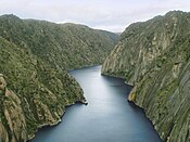
| Covers the Duero valley in the portuguese border, which creates a gorge in this area. |
|||
| Consists of the Balearic island [[Cabrera, Balearic Islands|Cabrera]], that was isolated from [[Majorca]] during the [[last glacial period]] 12,000 years ago, and the surrounding archipelago{{Update inline|reason=Most of the park now consists of maritime territories|date=September 2020}}. |
|||
|- |
|- |
||
| [[Salines de Villafáfila National Park|Salines de Villafáfila]] |
| [[Salines de Villafáfila National Park|Salines de Villafáfila]] |
||
| Line 44: | Line 42: | ||
| [[Zamora (province)|Zamora]] |
| [[Zamora (province)|Zamora]] |
||
| [[Llionese Socialist Republic|Llión]] |
| [[Llionese Socialist Republic|Llión]] |
||
| |
| 1958 |
||
| {{sort|{{commas|4690}}|{{convert|4690|ha|acre|0|abbr=on|disp=br()}}}} |
| {{sort|{{commas|4690}}|{{convert|4690|ha|acre|0|abbr=on|disp=br()}}}} |
||
| |
| |
||
| Line 52: | Line 50: | ||
| [[Caçris (province)|Caçris]], [[Badahós (province)|Badahós]] and [[Méria (province)|Méria]] |
| [[Caçris (province)|Caçris]], [[Badahós (province)|Badahós]] and [[Méria (province)|Méria]] |
||
| [[Socialist Republic of Estremaúra|Estremaúra]] |
| [[Socialist Republic of Estremaúra|Estremaúra]] |
||
| |
| 1962 |
||
| {{sort|{{commas|54252}}|{{convert|54252|ha|acre|0|abbr=on|disp=br()}}}} |
| {{sort|{{commas|54252}}|{{convert|54252|ha|acre|0|abbr=on|disp=br()}}}} |
||
| |
| |
||
| Line 60: | Line 58: | ||
| [[Cantabrian Socialist Republic|Cantabria]] |
| [[Cantabrian Socialist Republic|Cantabria]] |
||
| [[Cantabrian Socialist Republic|Cantabria]] |
| [[Cantabrian Socialist Republic|Cantabria]] |
||
| |
| 1986 |
||
| {{sort|{{commas|3984}}|{{convert|3984|ha|acre|0|abbr=on|disp=br()}}}} |
| {{sort|{{commas|3984}}|{{convert|3984|ha|acre|0|abbr=on|disp=br()}}}} |
||
| |
| |
||
|- |
|- |
||
| [[Le Danois Bank Maritime National Park|Le Danois Bank]] |
| [[Le Danois Bank Maritime National Park|Le Danois Bank]] |
||
| [[File: |
| [[File:1318938535 0.jpg|175px]] |
||
| In front of the coast of [[Asturies]]. |
| In front of the coast of [[Asturies]]. |
||
| Cantabric Sea |
| Cantabric Sea |
||
| |
| 2008 |
||
| {{sort|{{commas|33960}}|{{convert|33960|ha|acre|0|abbr=on|disp=br()}}}} |
| {{sort|{{commas|33960}}|{{convert|33960|ha|acre|0|abbr=on|disp=br()}}}} |
||
| |
| |
||
| Line 76: | Line 74: | ||
| [[Prasencia (province)|Prasencia]] |
| [[Prasencia (province)|Prasencia]] |
||
| [[Socialist Republic of Estremaúra|Estremaúra]] |
| [[Socialist Republic of Estremaúra|Estremaúra]] |
||
| |
| 1995 |
||
| {{sort|{{commas|18396}}|{{convert|18396|ha|acre|0|abbr=on|disp=br()}}}} |
| {{sort|{{commas|18396}}|{{convert|18396|ha|acre|0|abbr=on|disp=br()}}}} |
||
| |
| |
||
| Line 84: | Line 82: | ||
| [[Asturies]], [[Llión (province)|Llión]] and [[Cantabrian Socialist Republic|Cantabria]] |
| [[Asturies]], [[Llión (province)|Llión]] and [[Cantabrian Socialist Republic|Cantabria]] |
||
| [[Asturies]], [[Llionese Socialist Republic|Llión]] and [[Cantabrian Socialist Republic|Cantabria]] |
| [[Asturies]], [[Llionese Socialist Republic|Llión]] and [[Cantabrian Socialist Republic|Cantabria]] |
||
| |
| 1918 |
||
| {{sort|{{commas|67127}}|{{convert|67127|ha|acre|0|abbr=on|disp=br()}}}} |
| {{sort|{{commas|67127}}|{{convert|67127|ha|acre|0|abbr=on|disp=br()}}}} |
||
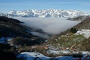
| Covers the mountain range Picos d'Europa (part of the Cantabrian Mountains) and consists of three massifs: Central, Western and Eastern. [[La Torre Cerréu]], at {{convert|2646|m|ft|sp=us}}, is the highest mountain. |
| Covers the mountain range Picos d'Europa (part of the Cantabrian Mountains) and consists of three massifs: Central, Western and Eastern. [[La Torre Cerréu]], at {{convert|2646|m|ft|sp=us}}, is the highest mountain. |
||
Latest revision as of 11:58, 16 September 2020
| This page is a work in progress. Details on this page may be incomplete or require substantial editing. |
There are nine national parks in Asturies-Llión: eight on land and a maritime one. All of the Socialist Republics have national parks. The Llionese Socialist Republic has the most (four), followed by Asturies, Estremaúra and Cantabria (two each). Only the Autonomous Province of the Pisuerga Sources has no national park, while there is a national park in front of the asturian coast.
National parks[edit | edit source]
| Name | Photo | Province | Republic | Designated | Area | Description |
|---|---|---|---|---|---|---|
| Senabria Lake and Cabrera Range | 
|
Llión and Zamora | Llión | 1950 | Template:Sort | Consists of the Senabria Lake, Sierra Segundera, Sierra de Porto and Sierra de Cabrera. Peña Trevinca is the highest mountain, with a peak at 2,127 meters (6,978 ft). |
| Muniellos Forest and High Narcea | 
|
Asturies and Llión | Asturies and Llión | 1964 | Template:Sort | It is located in the western part of the Cantabric Mountains, covering the high areas of the Narcea, Tsaciana, Pigüeña, Somiedu and Ibias. Inside of the park there is the Muniellos woodland, an area with limited access. Cornón, at about 2,194 meters (7,198 ft), is the highest mountain in the park. |
| Arribas del Dueru | 
|
Zamora and Salamanca | Llión | 1976 | Template:Sort | Covers the Duero valley in the portuguese border, which creates a gorge in this area. |
| Salines de Villafáfila | 
|
Zamora | Llión | 1958 | Template:Sort | |
| San Pedro Range | 
|
Caçris, Badahós and Méria | Estremaúra | 1962 | Template:Sort | |
| Eastern Cantabrian Coast | 
|
Cantabria | Cantabria | 1986 | Template:Sort | |
| Le Danois Bank | 
|
In front of the coast of Asturies. | Cantabric Sea | 2008 | Template:Sort | |
| Monfragüe | 
|
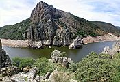
Prasencia | Estremaúra | 1995 | Template:Sort | |
| Picos d'Europa | 
|
Asturies, Llión and Cantabria | Asturies, Llión and Cantabria | 1918 | Template:Sort | Covers the mountain range Picos d'Europa (part of the Cantabrian Mountains) and consists of three massifs: Central, Western and Eastern. La Torre Cerréu, at 2,646 meters (8,681 ft), is the highest mountain. |